Note
Need help? Please let us know in the UMEP Community.
3.8. Spatial Data: URock Prepare
- Contributor:
Name
Institution
Jérémy Bernard
Gothenburg
Fredrik Lindberg
Gothenburg
- Introduction
URock needs building and vegetation vector data as input. This plugin convert Raster grids (DEM, DSM and CDSM) + building footprint to building and vegetation vector data with height attribute. For the vegetation, you can also provide points data (trunk location) and radius and / or height to create the vegetation footprint with height attribute.
- Related processors
- Dialog box
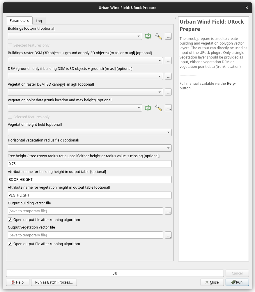
Fig. 3.12 The processing dialog for the URock Prepare module. Click on image for enlargement.
- Input parameters
Building footprint (optional)
Spatial input data containing buildings footprint as vector data
Building raster DSM (3D objects + ground or only 3D objects) (optional)
A DSM consisting of ground and building heights (in this case you should provide a DEM) or building height only.
DEM (ground - only if building DSM is 3D objects + ground) (optional)
A DEM
Vegetation raster DSM (3D canopy) (optional)
A DSM consisting of pixels with vegetation heights above ground. Pixels where no vegetation is present should be set to zero.
Vegetation point data (trunk location and max height) (optional)
Vector file containing points for each tree trunk and at least an attribute for tree top height or for tree crown radius
Vegetation height field (optional)
Name of the attribute used to store the maximum height of the tree
Horizontal vegetation radius field (optional)
Name of the attribute used to store the horizontal radius of the tree
Tree height / tree crown radius ratio used if either height or radius value is missing (optional)
Aspect ratio (height / horizontal radius) value used for all trees if height and radius are not given for all trees (default 0.75)
Attribute name for building height in output data (optional)
Name of the attribute expected in the output building vector file (default ‘ROOF_HEIGHT’)
Attribute name for vegetation height in output data (optional)
Name of the attribute expected in the output vegetation vector file (default ‘VEG_HEIGHT’)
Output building vector file (geojson or shp)
Where you want to save the building output file
Output vegetation vector file (geojson or shp)
Where you want to save the vegetation output file
- Remarks
The Raster and vector files should have a projection with meters as units.