Note
Need help? Please let us know in the UMEP Community.
3.19. Urban Land Cover: Land Cover Fraction (Point)
- Contributor:
Name
Institution
Fredrik Lindberg
Gothenburg
Niklas Krave
Gothenburg
Frans Olofson
Gothenburg
- Introduction
The Land Cover Fraction (Point) plugin calculates land cover fractions required for UMEP (see Land Cover Reclassifier) from a point location based on a land cover raster grid. A land cover grid suitable for the processor in UMEP can be derived using the Land Cover Classifier. The fraction will vary depending on what angle (wind direction) you are interested in. Thus, this plugin is able to derive the land cover fractions for different directions.
- Dialog box
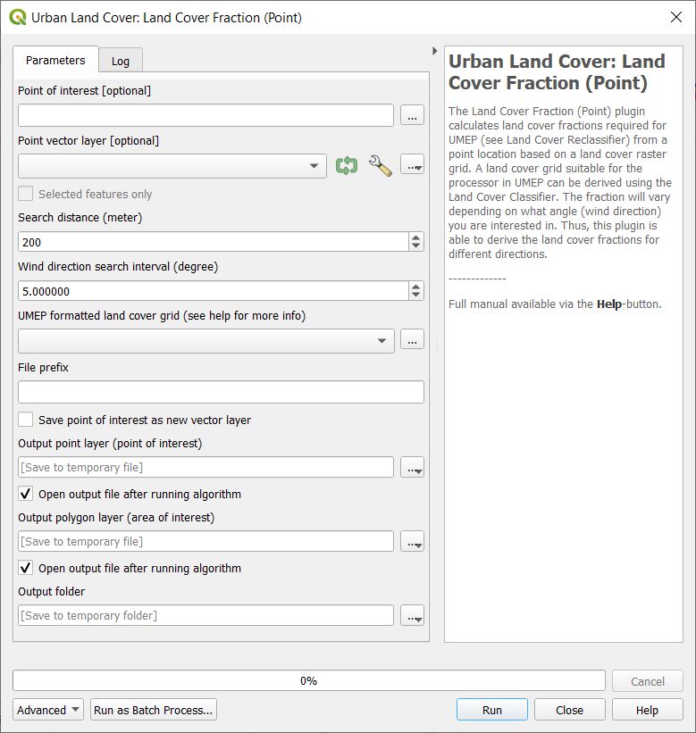
Fig. 3.47 The dialog for the Land Cover Fraction (Point) calculator
- Select Point on Canvas
Click to create a point from where the calculations will take place. When you click the button, the plugin will be disabled until you have clicked the map canvas.
- Use Existing Single Point Vector Layer
Select if you want to use a point from a vector layer that already exists and is loaded to the QGIS-project. The Vector point layer drop down list will be enabled and include all point vector layers available.
- Generate Study Area
This button is connected to the Search distance (m). When you click it, a circular polygon layer (Study area) is generated. This is the area that will be used to obtain the land cover fractions.
- Wind Direction Search Interval (Degrees)
This decides the interval in search directions for which the morphometric parameters will be calculated.
- UMEP Land Cover Grid
A integer raster land cover grid (e.g. geoTIFF) consisting of the various land covers specified above.
- File Prefix
A prefix that will be included in the beginning of the output files.
- Output Folder
Where the result will be saved.
- Run
Starts the calculations.
- Close
Closes the plugin.
- Output
Two different files are saved after a successful run.
anisotropic results: land cover fractions for each wind direction as specified are included.
isotropic results: all directions are integrated into one value for each land cover fraction.