Note
Need help? Please let us know in the UMEP Community.
5.3. Outdoor Thermal Comfort: Spatial Thermal Comfort
- Contributor
Name
Institution
Fredrik Lindberg
Gothenburg
- Introduction
The Spatial TC plugin can be used to make maps of thermal indicies making use of output from the SOLWEIG-plugin and the URock-plugin. All prior tools need to be executed via the Processing toolbox in QGIS and no filenames and folder structures should be changed. The Meteorological forcing file should be the same as used when executing SOLWEIG. This file can be found in the output-folder from SOLWEIG (metforcing.txt).
- Dialog box
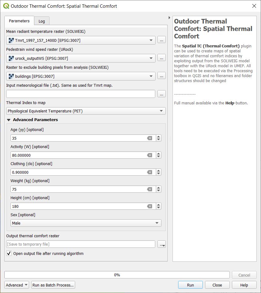
Fig. 5.3 Dailog for Spatial TC
- Basic parameters
Mean radiant temperature raster (SOLWEIG)
A raster grid originating from a SOLWEIG run. Filename should not be changed (Tmrt_YYYY_DOY_HHMMD.tif).
Pedestrian wind speed raster
A raster grid originating from a URock run.
Thermal Index to map
Here, a specific thermal index can be choosen. At the moment, PET is only available. More is coming!
- Advanced Parameters
Age (yy)
Used to calculate PET.
Activity (W)
Used to calculate PET.
Clothing (clo)
Used to calculate PET.
Weight (kg)
Used to calculate PET.
Height (cm)
Used to calculate PET.
Sex
Used to calculate PET.
- Remarks
The wind speed and direction columns found in the meteorological forcing data does not have to be the same used in URock. These column are used if PET or UTCI is calculated for Point of Interests (POI).
Air temperature and relative humidity is obtaianed from the meteorological forcing file used for Tmrt calculations. Time is derived from Tmrt filename.
All rasters used must have the same sixe. This can be accomplished by setting the URock output to be the same size as the SOLWEIG output.